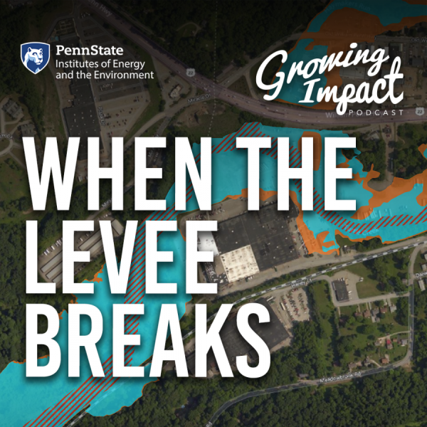
A team of researchers seeks to better understand the social effects associated with flooding, such as whether racial and ethnic minorities, children, and those with low income suffer the most.


Transcript
INTRO: There's these little communities that are perched right on top of those rivers. It made sense economically in the past when you needed a mill, maybe, and that's where you unloaded your food and all of those kinds of things. But today, it puts them at incredible risk, and many of those communities have tremendous environmental justice questions.
HOST: Welcome to Growing Impact, a podcast by the Institutes of Energy and the Environment at Penn State. Growing Impact explores cutting-edge projects of researchers and scientists who are solving some of the world's most challenging energy and environmental issues. Each project has been funded through an innovative seed grant program that's facilitated through IEE. I'm your host, Kevin Sliman. On this episode of Growing Impact, I speak with Lilliard Richardson, a professor of public policy and the department head of the School of Public Policy at Penn State. Richardson's research focuses on the policy analysis of health and safety policies. We discuss his seed grant project titled “Flooding, Hurricane Harvey, and Environmental Justice,” through which he and his team seek to better understand the social effects associated with flooding and development in flood zones, such as whether racial and ethnic minorities, children, and those with low income suffer the most.
HOST: Welcome, Lilliard Richardson to Growing Impact.
Lilliard Richardson (LR): Thank you.
HOST: Flooding from a hurricane is already a major challenge for a community, but you're looking even deeper. What are you investigating?
LR: Well, so there's really three levels that we worry about. One is the social vulnerability of individuals who are oftentimes in difficult situations. Now, I can talk about what that means more if you're interested in that. Second, we're interested in kind of the vulnerability of the community as a whole. And that vulnerability could be, for example, is your hospital, in a floodplain, is your school and in floodplains. And so unfortunately sometimes these kinds of vulnerabilities doubled down between those two types of vulnerabilities. And then third is the physical vulnerability of properties and of kind of the area. And the physical vulnerability is more like the work that hydrologists or others, engineers and others around the university might do. But we're mostly interested in the policy aspects. What affects the communities? Public finance, what makes whether a community has adopted certain kinds of policy to mitigate flooding. And then again, how those individuals are affected. So it's really good at those two areas that we're trying to understand. And the availability of data, big data, as people sometimes say, it has been really incredible in what's available now. And so you can get information on almost every property in America. You can find out—there's incredible information about what part of your property might be along a floodplain, what parts not, you know, all those kinds of information. And so we've really, it takes sort of the resources in place like Penn State to be able to do some of this stuff because we've already used the Roar supercomputer, and we're probably using more terabytes of data to do this than they did to put a man on the moon with the Apollo mission. It's like 15 terabytes, which it's hard to even imagine those kinds of terabytes. So that's kind of what's driving this is trying to really dig down into that data at a parcel level, the individual property level. And then kind of the next step will be once we sort of identify that in a really detailed rich way is to really start to understand more about the people that are affected themselves by this. But understanding better like who really is most vulnerable, which properties had been sort of damaged repeatedly? Which ones are sort of due for it, those kinds of things. And then again, how it interacts with those community and policy level kinds of issues.
HOST: What's the inspiration behind the project?
LR: Well, it actually started probably five, six years ago that we actually started to really get interested in this topic. And it was, it was a conversation with a couple colleagues over lunch and how these things can happen. And that's one of the things we sort of lost with the lockdown unfortunately, but hopefully we'll get back soon. And I've done a lot of policy work that's both health and state level kinds of issues. Lot of my work has been around safety and those kinds of things. And as we kept talking about the issues, some of the same social vulnerabilities, the kind of equity issues that you're finding and maybe the health care system and the kinds of social determinants of health care that we, that we oftentimes do research on. Those things seem to be sort of magnified by the folks who are vulnerable in these ways to flooding and other kinds of disasters. And so I've, I've partnered with a couple of folks who have looked at this in different ways, but didn't really this data availability, just the last couple of years has really exploded and allowed us to think about some of these questions are much more micro way. Rather than just saying, you know, all the folks that live along this river are at risk. Here's specifically the folks who are at like 8 out of 10 kind of risk. And here's the folks who are 6 out of 10, and here’s the folks who are 2 out of 10. And trying to understand that in a much more nuanced way.
HOST: How are flooding and environmental justice connected?
LR: There’s really two major risk of flooding in America. There are people who were along the coast, particularly hurricane threats along the Gulf Coast and the South Atlantic states like South Carolina and North Carolina. And coastal flooding tends to be, not entirely—we know from like Superstorm Sandy some of it did hit some lower-income houses. But oftentimes, coastal damage is much more to second homes, vacation homes, people that have invested in that are oftentimes upper middle-class. Riverine flooding, which is along rivers like the Juniata and those kinds of things and the Susquehanna here locally. There's these little communities that are perched right on top of those rivers. It made sense economically in the past when needed a mill, maybe, and that's where you unloaded your food and all of those kind of things. But today, it puts them at incredible risk, and many of those communities have tremendous environmental justice questions because it tends to be the poorest people living in many of those most vulnerable homes. A lot of the schools, public services are also very vulnerable. So the town as a whole is vulnerable. And those folks that are there. There are some tremendous questions there about who ends up paying the price. And of course, there's the broader environmental justice issues about rising sea levels and those kinds of things that are also sort of built into this question about flooding. But a lot of that is more on the coast, like I said. And so we've actually separated our research into more coastal flooding issues and more inland coastal issues. And we are finding some differences and the impact that it has on things like housing values and density of housing and those kinds of issues.
HOST: What is the concern about how flood zones and the communities within them are created? Is this something you'd label as systemic racism?
LR: There's two questions in there, maybe more. Systemic racism many times in the past, there were red line districts within that both banks and communities used to limit who can have access to loans. There's quite a bit of evidence that those red line areas tend to be more likely to be vulnerable to flooding in addition to vulnerable in the more traditional social vulnerabilities we'll talk about for folks that are lower-income and struggling in various ways. And so the, the question between the red lining and kind of long-term structural issues of how communities were built, that's pretty straightforward and there's, there's a fair amount of evidence on that. There's less about kind of the individual level of houses and parcels and the individual level of community structures at risk. And so say for example, a coastal person might still have their high school on very safe ground. But if somebody who's one of these riverine communities and because of the systemic racism in the past that the school was built and also a low lying area that's also at risk, there again, kind of multiplication facts here, you know, that happening for some of these communities. So the individuals and then the school at the same time. So that's, that's kind of that historical kind of structural issue that it's there. Then in terms of the flood maps themselves, basically the NFIP came about in the sixties, early seventies, most of these were really developed. Not all communities still have been mapped. Not all rivers are mapped. You think they would be in today's society, but many of them have not. And there is a political factor—now we have not gotten to this part of it yet. This is kind of a longer-term question for us, but it is sort of this political factor of whether you put a house in to the flood plain or not affects their ability to buy insurance. Whether a community participates in these certain policies—it's a thing called CRS, the community rating system. If the community participates in that, it can actually lower the insurance rates, the flood insurance rates for the houses in that community. But which communities didn't have the resources to participate in the CRS, to do the kind of things that mitigate the risk. It's oftentimes the wealthier communities. And so that's part of this too, is how does, how did these policies like the CRS and various other kinds of development policies that cities and communities can use—how do they shape the risk that's available to folks? And part of this is an administrative capacity. Which communities have the kind of staff, the kind of resources to get this done? Some of its political will. So these different things and come together. But certainly that administrative capacity could shape whether or not you're focusing on storm water drains, for example, and focusing on whether you do what you need to protect your school or your city hall, or somebody's other public infrastructure types of facilities. It all kind of gets tied together in these ways between kind of the environmental justice issues and who’s most vulnerable. And that's what we're trying to break apart. There are some other issues kind of down the line that have motivated some of this that are, a couple of our other colleagues that are on this are more interested in the health and education outcomes for children. So this affects a school, not only does the kid get displaced by the flood, but then maybe the school is closed down for six months. What type of learning outcomes as this have on a long-term basis for those children? And so there's a lot of work on kind of how any displacement affects children's development. That's an issue that a couple of my colleagues from the project or particularly in tune with.
HOST: Part of this is to build a new database if I understand it correctly. So why is it important to create this database with this new information?
LR: A lot of the past information on this stuff was really at the broad level, like zip code level. And when we think about a community, zip code can be pretty broad. I mean, it can be like State College, only two or three of these that are covered most of the population. And so it certainly doesn't help you understand that particular community that might be along a river or that's along a particular creek that repeatedly floods, or that it's at the bottom of a mountain that maybe repeatedly floods. And so maybe in some rural areas, a zip code might give you a pretty good sense of who's at risk. Or I should say, sort of urban areas and make it be a pretty good sense of risk. But a rural zip code can be very large, too. And so part of what we're trying to understand is these little bitty towns like Williamsburg that's down south of here, that's kind of near Huntington and Altoona, a little town out by itself. What type of risks is that type of town? And so this database is allowing us to not be at just the zip code level or at the kind of massive flood level, but we can actually say this house at this latitude and longitude is that, you know, like say on a scale from one to 10 to make it simple. They’re a four. They’re six or whatever it is. And then could also though based on now because there's so much data out there, based on the county assessor data, we know that that's a 1200 square foot home or a 2400 square foot home. Or if it was assessed at a million dollars or whether it was assessed at $200 thousand. And those are all public records. But getting them all in one place is labor intensive, both in terms of human time and in terms of computing resources to try to do that. And then when you start overlaying things like elevation, the flow of the water, which way the water is going. And then the maps at FEMA puts out those are constantly being updated. And there are some communities— so kind of going back to whether the equity issues on this, there are many communities, counties that don't have the resources to do this, and it tends to be coastal counties get the attention. Big population counties tend to get this kind of stuff. And a lot of rural communities don't get the kind of redefinition of these floodplains that these other areas do. And so that also can create some issues because the floodplains that were built in the sixties aren't necessarily that accurate. Plus they were doing broad—It was like they would just draw a circle and say, everything within this circle must be it. Well, there might be a big hill in the middle of that circle and that wouldn't be at risk. But there also could be some little, little cutoffs off of that that aren't being covered in the right way. And so some of the more wealthy communities have gotten down to where there's somebody said they're looking at a map and looking at elevation and knows this house should be in the floodplain, but the house next door shouldn't be. And so they're starting to get more and more refined. But that's the kind of data we need. And are you behind a levee or are you behind maybe some kind of berm that's been created or is there nothing between your backyard and the creek or river, that kind of thing. So it's layering on lots and lots of data into one place. And the final thing I would add is that data like municipal finance, public infrastructure types of stuff, the school district data, those kinds of things— they’re oftentimes in completely different kinds of datasets that aren't attached to this kind of individual level data. And so consequently, pulling those together and trying to match up like the municipal county lines with which houses are in a floodplain—this is a very time intensive type of process. The data's there, but getting it all into a place that can answer the questions that we have about who's at risk, both at a community level but also an individual level is so important.
HOST: When you get this information all in one place and have this database, what are some concrete ways to address those findings?
LR: I just got off the phone with one of our colleagues over the Sustainability Institute. And we were talking about how we, as a next step, can partner with some either regional watershed type of associations or communities to start to understand how they can kind of make use of some of this data. Where it would not be just academics, but what would be accessible to somebody who maybe doesn't have a PhD in understanding how to do spatial econometrics. And we certainly have academic questions. We’ve got things in academic journals, but how do we make it in some kind of toolbox so it's available for communities to make some use of it. And we’re not necessary the ones they're going to fix these inequities. But the first step is oftentimes just finding out where are the inequities, where are the vulnerabilities? And then hopefully getting that information into the right hands so that the folks that are policymakers who are deciding zoning laws and things like that, can use that information hopefully in a good way to sort of address and ameliorate some of those inequities that are out there.
HOST: Are there any next steps or future plans besides already what you mentioned that maybe you would talk about for this project?
LR: Yes, at this stage, this is really data-intensive. And so at this stage we've done something like ten states. And we just started really working on Pennsylvania. It started with the Gulf and kind of southern Atlantic states. And but it is pretty time-intensive and so it takes, it just takes a while to add on each state. And I think the thing that I think anybody in Pennsylvania would know, the Pennsylvania has a tremendous number of floods, and it's had tremendous level of damage over the years. People might not think about North Dakota, South Dakota, places like that also our pretty considerable risk themselves. And some of the worst damage inland was a couple of years ago, when downtown Des Moines was heavily damaged by flooding and people just don't think about that out there in those parts of the country. As there's certainly as we build up the database and start to cover some of those other parts of the country, that's one of the goals is to be able to cover more areas. And then I think like I said, some of my colleagues are really more interested in now that we have this kind of information, trying to understand a bit more at the individual level, the human level through perhaps qualitative methods or ethnography or those kinds of things. How do we start to understand how people sort of process this information? How do they process risk? Do they, for example, a little thing like Texas now has a disclosure law for renters on whether they're in a floodplain. Some states don't even require disclosure when you buy a house. So how does that disclosure shape your thinking about when you buy or rent property? And so we don't know a lot about that. I mean, there are some studies out there. There are other folks working on this area. Obviously, it's a huge area, but those are the kind of things and I'm going to try to eventually get to it, is kind of that broader understanding of how this impacts the community. So hopefully that's a future step, but
there's plenty of data work between here, so we’ve got ourselves quite a research agenda for a while.
HOST: Thank you for spending time with us on Growing Impact, Lilliard.
LR: It was great to meet you and talk to you today. And if anybody's interested in flood research and wants to reach out to me and the team, it’d be great to work with them.
HOST: You've been listening to Growing Impact, a podcast by the Institutes of Energy and the Environment at Penn State. I’ve been your host, Kevin Sliman. This has been season two, episode nine. Thank you for listening.