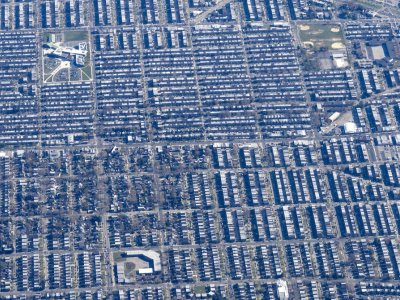
Urban agglomerations are typically warmer than their surrounding rural areas due to the “urban heat island” (UHI) effect, one of the most evident anthropogenic interventions on climate. Climatic changes and increased heat stress in cities cause severe discomfort in outdoor activities. The impacts of UHIs are the leading cause of summertime morbidity, particularly in those population groups with pre-existing health conditions (asthma, COPD, cardiovascular diseases, etc.). They disproportionately affect low-income populations, communities of color, and the elderly. Conversely, outdoor thermal comfort in urban spaces is known as an important positive contributor to pedestrians’ health and is central in the assessment of urban livability. To improve the outdoor comfort levels of urban agglomerations, urban planners, architects, and building engineers need to better address urban microclimate conditions in their designs and urban masterplans. While the field of urban climatology has widely studied UHIs, the building sector is still confronted with the lack of a professional framework for urban microclimate assessment and design implementation.
To fill this gap, this project develops a novel workflow that couples the “local climate zone” (LCZ) classification system, which is mainly used in urban climatology, and a new urban microclimate assessment tool (ENVI-met), which simulates the thermal index of urban spaces. Using this workflow, the urban thermal comfort of two U.S. high-density cities located in different climate zones (Philadelphia, PA and Houston, TX) will be mapped for different seasons and different urban neighborhoods/blocks. To reveal the correlation between comfort levels and the social context of the studied urban settings, the produced outdoor comfort maps will be overlaid with GIS socioeconomic maps of urban neighborhoods within these two cities.
The results of this study will, first, inform architects, urban planners, policy makers, and communities about the relationship of outdoor urban climate and socioeconomic factors, and associated potential inequalities; and second, educate architects and urban planners about the implementation of urban climate knowledge into planning and design of healthful and resilient environments.
Related Publications
- Hashemi, F. (student author), Poerschke, U., Iulo, L.D., and Chi, G. (2023). “Urban Microclimate, Outdoor Thermal Comfort, and Socio-Economic Mapping: A Case Study of Philadelphia.” Buildings 13(4), Special Collection: Performance-Based Urban Design: Integrated Urban Analytics, Simulation and Climate-Responsive Design, 15 April 2023. MDPI, Basel, Switzerland: 19 pages. 13041040.