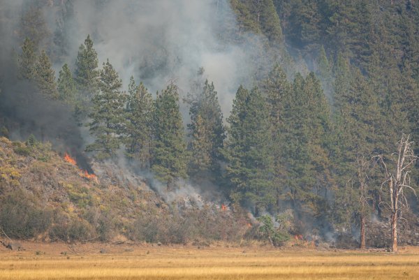
The extent and severity of wildfires in California has increased in recent decades increasing risks to lives, property, and forest ecosystem services (e.g., water quality, biodiversity, carbon sequestration). Changes in climate and fire weather and increases in fuel are two important contributors to this fire problem. Fire spread and fire intensity/severity results from interactions among vegetation/fuels, topography, and weather.
In mountainous terrain, the development and erosion of temperature inversions in the atmosphere is thought to be an important process influencing fire behavior and spatial variability in fire intensity/severity. Periods of rapid fire spread with high fire intensities under low wind speed conditions and lifting inversions have been documented but the driving mechanisms remain poorly understood. Near-surface atmospheric conditions and vertical mixing in the atmosphere likely play critical roles during these events, but a lack of observations limits our ability to understand and predict them.
Recent advances in the Weather Research and Forecast model (WRF) and data assimilation techniques now permit down scaling of atmospheric dynamics in the Planetary Boundary Layer, the level of the atmosphere near the surface that is impacted by terrain and other surface conditions, at high horizontal (≤1.0 km) and vertical resolution (10 m). The objectives of our project are to: 1) improve the understanding and prediction of rapid wildfire growth enhanced by local atmospheric drivers; and 2) determine if the development and erosion of inversion conditions are important factors in driving forest fire intensity/severity. These objectives will be accomplished by modelling atmospheric conditions at very high resolution and statistically relating fire spread and fire intensity/severity to observed fire weather, simulated fire weather, terrain, and surface fuels for five fires with documented periods of rapid spread under low wind speeds in the Klamath Mountains.
Researchers
Eric E. Knapp

Clint Isbell


