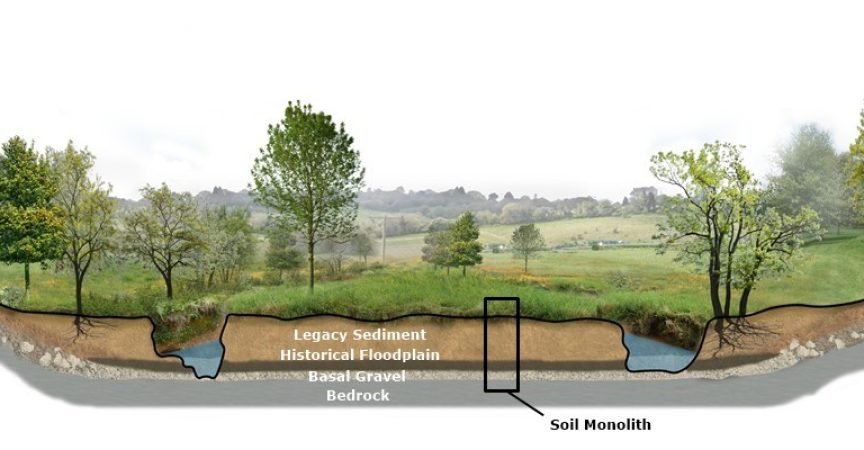
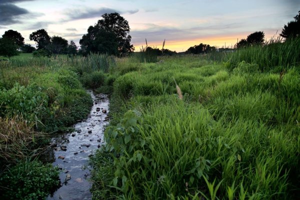
Floodplains have been significantly altered since European settlers introduced mill dams and timbering, which increased erosion and led to rapid sediment accumulation. This transformation dramatically changed the natural landscape. Floodplain restoration regains the ecological benefits of the pre-industrialization landscape and is an effective method to improve water quality, prevent erosion, and boost biodiversity.
LandStudies specializes in this restoration work, and their efforts are greatly supported by the Penn State Radiocarbon Laboratory and Brendan Culleton. The laboratory's role is crucial in dating soil samples collected during restoration projects. To accurately reconstruct the original floodplain conditions, LandStudies extracts soil core samples up to eight feet deep, which provide a historical profile of the land extending back 10,000 years.

From these core samples, LandStudies collects organic materials like wood, seeds, and nuts from different layers. These samples are sent to the Penn State Radiocarbon Laboratory, which determines the age of each layer. By analyzing multiple radiocarbon dates and integrating them with other measurements, LandStudies can accurately recreate the historical landscape. This detailed understanding guides their restoration efforts, helping to restore the floodplains' ecological functions to their original state.
“There is a wealth of information in soil samples, but deciphering multiple layers can be complex. That's why obtaining multiple radiocarbon dates from different layers is crucial. Our collaboration with the Penn State Radiocarbon Laboratory has significantly deepened our understanding of the natural condition which informs the design of our restoration projects.”
—Justin Spangler, Water Resources Engineer, LandStudies


