Wetlands are some of the richest ecosystems in the world. They support an extensive variety of plants and animals, from the smallest of microbes to the largest of mammals. Wetlands also filter and protect water, improving its quality. However, as climate change intensifies, wetlands are threatened by changes in precipitation, both too much and too little. They may also provide early signals of climate change impacts.
Transcript
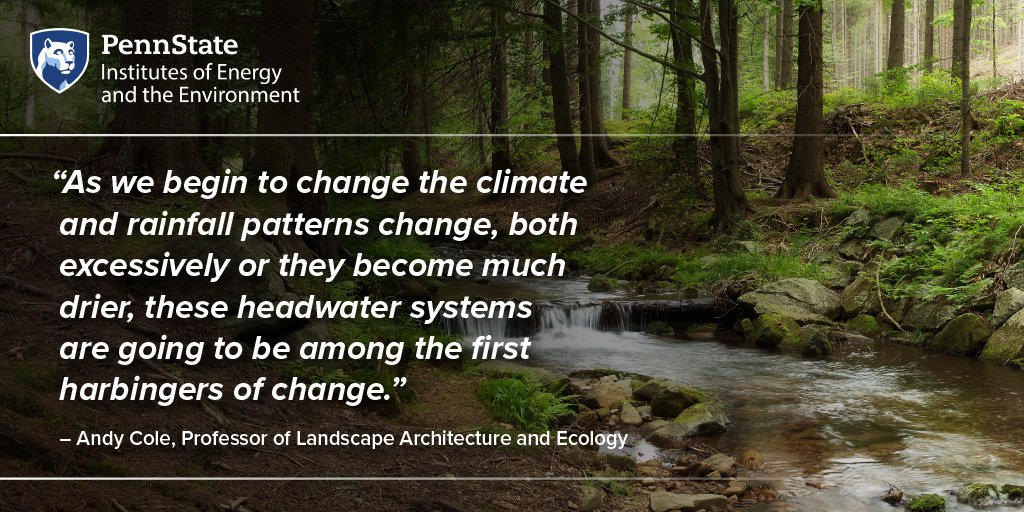
INTRO: As we begin to change the climate and rainfall patterns change, both excessively, as you can see in Kentucky, or become much drier, these headwater systems are going to be among the first harbingers of change.
HOST: Welcome to Growing Impact, a podcast by the Institutes of Energy and the Environment at Penn State. Growing Impact explores cutting-edge projects of researchers and scientists who are solving some of the world’s most challenging energy and environmental issues. Each project has been funded through an innovative seed grant program that is facilitated through IEE. I’m your host, Kevin Sliman.
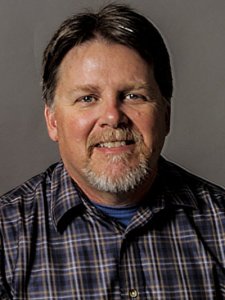
HOST: On this episode of Growing Impact, I speak with Andy Cole, a professor of landscape architecture and ecology and the director the Ecology plus Design Program. He is a wetland ecologist by training with a wildlife biology background. His research interests lie with restoration ecology as it applies to damaged landscapes, usually wetlands. His seed grant project titled “Wetland Hydrology and Plant Community Composition – A Reassessment of Site Conditions a Decade Later” looks to reinstall instruments on wetland sites that he started measuring nearly 30 years ago. This is to assess hydrologic changes that have occurred due to climate change and other factors.
HOST: One note for listeners: In this episode, Andy refers to Robert Brooks, a colleague that he worked with for many years. Rob was a professor of geography and a renowned wetland expert at Penn State for nearly four decades. He died in 2021.
HOST: I'd like to welcome Andy Cole to Growing Impact.
Andy Cole (AC): Thanks Kevin. I appreciate that. I'm a wetland ecologist over in the Department of Landscape Architecture, and I like getting my feet wet, but I don't like getting into areas that are too deep.
HOST: Could you provide some context and background about your current project?
AC: Sure, this actually goes back almost 30 years. When I first came up to Penn State, I was working with the late Rob Brooks. What was then the Co-operative Wetland Center and then became Riparia. And I came up as a research associate, and Rob gave me the opportunity to look at hydrology and a lot of sites, which ended up at somewhat over 200 sites, I think. Over time, I ended up instrumenting—I actually lost count—but I think it was well over 60 of those sites, plus some additional sites of my own. It was just to try to get some sense of the behavior of these particular sites. Hydrogeomorphic (HGM) assessments so that we can be able to predict behavior of a lot of these wetlands just based on sort of where their position in the landscape was and how the water behaves. Nobody ever really done what Rob and I had proposed to do, which was just to try to generate some data on just basic wetland hydrology. I'm not a hydrologist, I've never claimed to be one and actually several hydrologists mad at me for what I was doing just because it was classical hydrology. But some of those sites ended up with more than 12-year runs, maybe 13-year run, was the longest I had, which is pretty unusual because most hydrology studies would— you do a graduate student, you get two, maybe three years and you're done. And I had a good run on some of these sites. Ultimately, these were all remote instruments. A lot of this is pre-internet actually, and I was out visiting them, but they're all remote collecting of data and I would have to go out and download it on, at that time an old calculator. And things just wore out. I ended up moving on to the Department of Landscape Architecture, which I now been out for quite some time. Rob and Riparia went in different directions. It just occurred to me fairly recently—I mean, I'm wetland ecologist by training and climate change is becoming more and more a thing. And a lot of these sites are up on the ridges, which and they’re headwaters sites, right? As we begin to change the climate and rainfall patterns change, both excessively, as you can see in Kentucky, or become much drier, these headwater systems are going to be among the first harbingers of change. And so I thought, Well, shoot, I've got some of these sites that I knew had a long run of data. Can I find some resources to re-instrument them? I put those back in the ground and also started taking plant data. We had taken plant data back in the day. One of the things Rob that he did really well is he put a lot of that data up on the internet on the Riparia site. So I can go back and I can look at what those sites were, at least the dominance and see what I get now to see whether there's been any change to watch these over a longer period of time. Again, my hope is to keep these things going again for a good amount of time. Because if there is a change, if there's a signal, I want to be able to see it.
HOST: Why is it important to revisit this research a decade later?
AC: It takes several years actually it took to get a reliable signal. And especially on some of these sites that are not groundwater. The groundwater-fed sites, I could probably measure that for a couple of years and feel pretty confident in how they behave. The ones that are more surface-water fed or a mix of groundwater and surface water behave very differently. And sometimes it takes years to get a proper signal. Coming back in after that period of time, it’s going to take us several years to figure out whether there was a change in the signal over time. And the same thing happens with the plant data. It's not an immediate thing. Soils will take, could take a century to change if they do change. But the plants, that's going to take more than just the next year, as will the hydrology. So the whole thing—now that climate change is—we knew about what was coming ten years ago, but it's sort of in your face now. And it just seemed important to go back onto these sites if I had the opportunity and try to get them going again, to keep them long term, just to see if we can pick that signal up because of these things start to dry out or change, that’s in my humble opinion, is one of the canaries in the coal mine, if you will, of problems that are going to start happening in the Appalachians. And again, you see what's going on in Kentucky right now with the flooding. That's the kind of rainfall that we really haven't seen historically and don't want to see. And if that happens on these sites, they are going to change.
HOST: Where and how did you choose the placement for these instruments?
AC: The site selection, the way back when was a little bit of a chicken and an egg setting. We were trying to determine how to generate this hydrogeomorphic classification. So at some point, we were making best professional judgment guesses about site selection. And then after several years of both the plant and the soil and the water data, we settled on a pretty good classification system. And so I simply went back to some of these sites that were groundwater-fed at a few of them, a mixture of groundwater and surface water and surface water. Trying to get that spread of hydrology at sites where I had back in the day, I had a long run up data—a mixture of the HGM classification, mixture of the water source, and then just resources I add available to go re-instrument tem. In our classification system, we had what we call riparian depressions, these are groundwater-fed basically little bowl-shaped seeps that are found in the landscape adjacent is streams and just pump out water constantly. Because they are groundwater-fed, they are less affected by droughts. I also have some sites that are wetlands that are on slopes, also often groundwater-fed, but because they're on a sloping system, they, gravity will take the water downhill and they don't stay as wet. And they also get some, obviously get some rainfall and so on. All the sites of course get rainfall. And then there's the sites that are along that are affected by flooding. Headwater floodplains, mainstem floodplains, depending how you identify those, whether their source of water might be sort of groundwater-fed from the effect of the stream itself moving up, so up into the riparian zone. But also the areas that get flooded. We haven't had a really good snow-melt flood in quite some time, but it's those kind of things where they can actually get the extremely dry in the summer. In fact, this summer, I'm sure they are. I haven't been on the sites for a couple of months now, but some years they're under ten feet of water and most years by this time, they're bone dry and if you don't know what you're looking at, you don t know they're a wetland. To me the one little addition, one important aspect to understanding those floodplains sites is that most people will walk those this time a year and will argue with me that they're even a wetland, right? And so these riparian zones adjacent to rivers and streams are important in a lot of ways. Buffers, for example, for keeping stuff out of the streams, but they are also important of their own and they are a type of wetland that naturally dries out. Those trees don't germinate underwater. Those settings have to be dry for the trees to germinate and then they are adapted to the occasional deep flood and they are wetland sites. But this time of year, we are in August, this time of year, they are going to be very dry.
HOST: How can this information be valuable?
AC: For a guy likes getting his feet wet, it just has value in and of itself, right? These are some of the more interesting ecological sites I've ever been on. They are all, to me, especially, I mean, let me give an example, the riparian depressions, especially the ones up on the first and second-order streams, I have long believed that a lot of the chemistry that occurs in those streams is influenced greatly by the output of those riparian depressions, being organic matter and all sorts of stuff into this training methods, not to mention the base flow itself. Again, just naturally this time of year stream flow is low. But these riparian depressions because there's a groundwater-fed, keep that stream full or at least flowing. Right? So if you're a fan, for example, of trout fishing and especially brook trout. Again, I've never tested this, but I've sort of come to the belief that a lot of these streams that had trout streams are that way and a lot of the chemistry that way because of these riparian depressions.
HOST: When you do have all this information from the historical data and the stuff moving forward, who can benefit from the information that you plan to collect and then share out?
AC: You know, the folks that manage these sites that are working in the streams, the Fish and Boat Commission, of course. At the state and federal level, wetlands are still protected, maybe a little less so than I would prefer. But what we've been able to show is that some of these sites that people may not have in the past have thought of as wetlands are now actually classified as wetlands and get that protection. And again, on those riparian zones, whether it's headwater or mainstem, keeping those riparian zones protected allows for a lot of benefits, not the least of which is helping Pennsylvania meet their Chesapeake Bay goals. And whether it's a wetland or just, just like put that in quotes, are just a riparian forest. It is, it's pretty important. So these, I think this data is what Rob put together over the years and what this little bit that I'm following up on has really helped inform the state and federal managers that have to deal with wetland protection and giving them additional information on the benefits and why we work to keep these sites, even if they're small, which a lot of these sites actually are pretty small.
Do you anticipate or have you seen this data being used by other researchers, maybe in other studies to forward their work?
AC: The hydrology data has been—the data itself has not been used, but the approach has been used to help the other areas develop their hydrogeomorphic assessments. And again, the State DEP, Pennsylvania DEP and the federal EPA have used what Rob and his group over the years I put together to help their plan and how they assess wetlands in the Eastern United States. So it really has been sort of behind the scenes, but it's been a real big benefit, I think, to a lot of folks.
HOST: Do you have any future plans for this? Any ideas where this might go and might where the data might be used or how you might progress in this project?
AC: I think before I retire, I really would like to see whether whether those riparian depressions actually do what I think they do. And so it's not just me. I mean, I'm a plant and water guy, and I need help with the soil, and the critters, especially in-stream and adjacent. So I would like to take, once I get some of this baseline data over the next couple of years, like to bring some more folks in, especially soil scientists and the folks that work in the streams. Because I really want to see if, whether I'm making this up or whether it's really true, how much those groundwater seeps actually do impact those headwater streams. That's where I'd like to take this.
HOST: Thank you, Andy for spending time on Growing Impact of talking about your research.
AC: Thanks, Kevin. anybody who is interested in this, I'm happy to answer any emails. I’m cac13@psu.edu. And you can always get me to talk about wetlands, I'm happy to do it.
HOST: You've been listening to Growing Impact, a podcast by the Institute of Energy and the Environment at Penn State. I've been your host, Kevin Sliman. To learn more about IEE and to hear previous episodes of Growing Impact, please visit iee.psu.edu. This has been season three, episode two. Thank you for listening