
Many of us watched closely as Hurricane Ian impacted Florida and the people living there. This close attention to the storm has caused many people to ask questions about some of the images they have seen of reverse storm surge.
Reverse storm surge is simply a phenomenon that occurs when the wind is blowing away from the shore and literally pushes water away from the coast, causing water to recede from the shoreline like an extremely low tide. The phenomenon of reverse storm surge is not directly related to anthropogenic, or human-caused, climate change. However, the dynamics of Hurricane Ian exemplify the predicted effects of anthropogenic climate change.
Understanding reverse storm surge
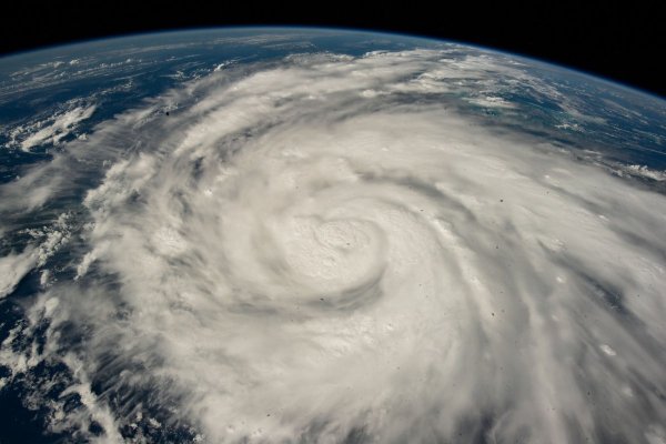
Hurricanes are cyclonic storms driven by heat rising from the ocean to the upper atmosphere. In the simplest terms, wind rushes to fill the space left by the rising warm air, and cyclonic motion is induced by a phenomenon related to the Earth’s rotation. The storm’s rotation can be seen in the exhaust vapors of the storm when viewed from above. Rotation can significantly affect the relative power and direction of the storm surge. The side of the storm where winds are moving in the same direction as the storm tends to be more powerful because velocities are additive.
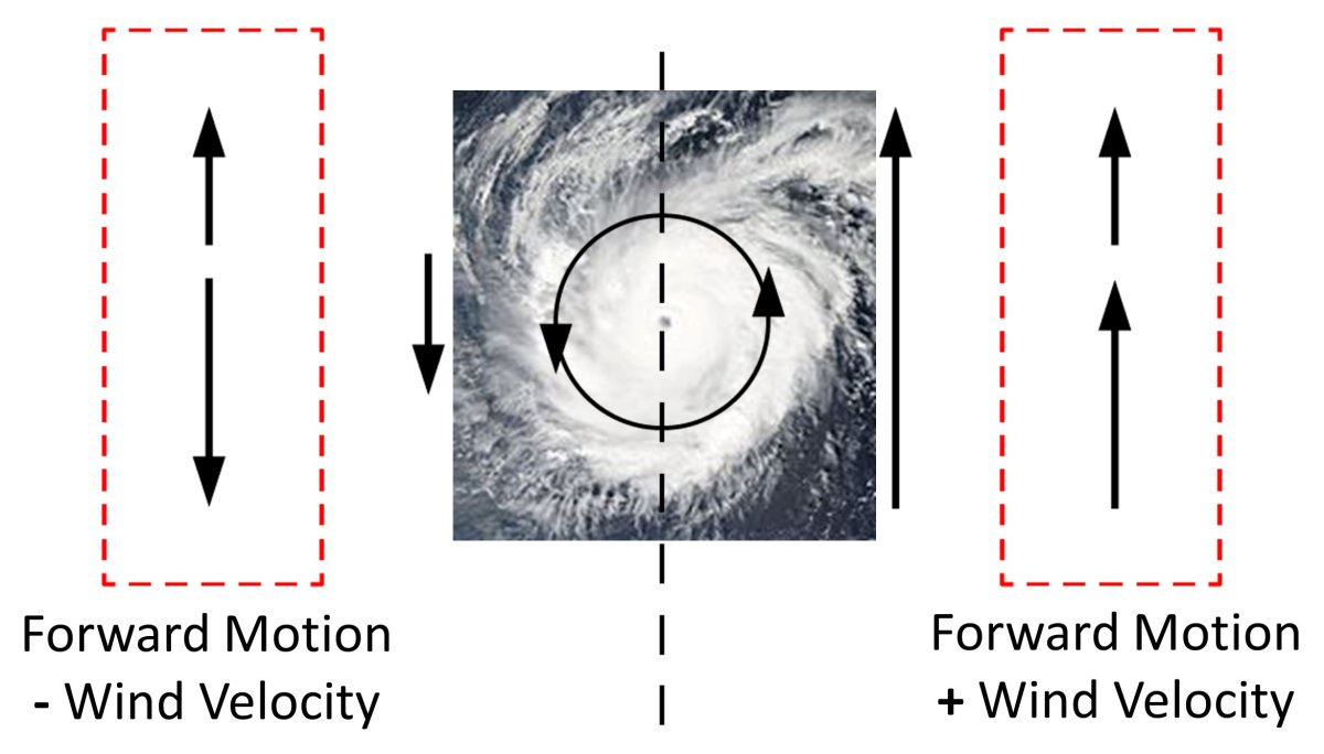
(Diagram by author. Hurricane image by NASA Goddard Visualization Studio.)
Reverse storm surge occurs when a storm makes landfall in such a way that significant winds blow offshore. The geography of the Florida Peninsula and the northward trajectory of most gulf storms makes it likely that significant winds will blow towards the west when storms hit Florida’s west coast, though “reverse storm surge” can happen virtually anywhere where winds and geography align. This occurred at Cedar Key, Florida, when Hurricane Irma made landfall in 2017 and has happened again at Tampa Bay during Ian in 2022. The four-foot difference between the predicted tide level (the blue line) and measured water level (the red line) can be seen by observing the NOAA tide gauge near Tampa Bay.
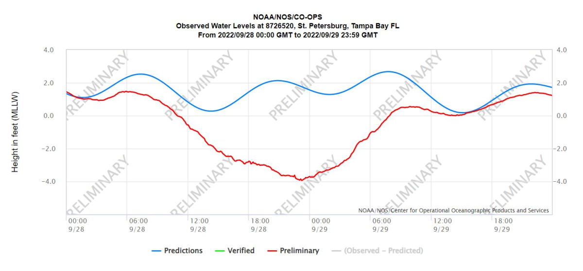
(NOAA)
Therefore, the place where a storm makes landfall is incredibly significant. Had Ian made landfall near or to the north of Tampa Bay the most powerful winds would have literally pushed water up into the bay, and the combination of wind and physical geography would have amplified the surge in the bay instead of emptying it.
What does this have to do with climate change?
Reverse storm surge is a physical phenomenon that would occur regardless of anthropogenic climate change. However, it’s important to recognize that Hurricane Ian precisely reflects predicted effects of anthropogenic climate change. Increases in ocean temperatures increase the differential in temperature between the sea surface and upper atmosphere, adding power to the heat engine that drives storms. Thus, while storms have historically intensified in the warm waters of the Gulf of Mexico, greater ocean temperatures will cause them to intensify more. Warm ocean temperatures also pump more water into the atmosphere through evaporation, increasing precipitation.
The phenomenon of reverse storm surge observed during hurricanes Irma and Ian shows us how the intersection of physics and geography shape storm impacts. A change in a storm track and the unique geography of a place can cause a significant change in outcome. Those of us engaged in hazard and risk communication worry about this because people often assume their past experiences are predictive of future events. Just because a storm, or series of storms seem insignificant in your location doesn’t mean that storm track and geography won’t one day align and deliver the kind of devastation we’re tragically seeing in Ft. Myers now. The effects of anthropogenic climate change only make it more likely that such events will be described as “historic” and “unprecedented.”
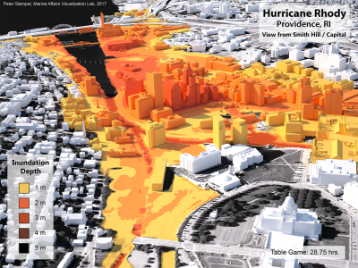
Peter Stempel is an associate professor in the Department of Landscape Architecture and is a cofunded faculty member of the Institutes of Energy and the Environment. His work links physical models such as hydrodynamic and wind models to qualitative data gathered from stakeholders and visualizations.