The world’s longest-running pandemic, cholera, presents a pervasive threat to global public health. While substantial gains have been made in terms of cholera treatment and prevention, many parts of the world remain susceptible to endemic and epidemic cholera. Moreover, the populations most vulnerable to cholera are often the least equipped to respond to this health threat due to resource constraints or a lack of reliable and dynamic public health information. This is problematic as limiting cholera risk in areas without centrally managed water and sewerage infrastructure requires households to individually reduce their exposures to potentially contaminated water sources through behavioral responses such as drinking water treatment, reduced surface water reliance, and improved hygiene and sanitation practices. Existing research suggests that providing households with early warning of their local cholera risks could help them make such investments in safer water, sanitation, and hygiene practices in a timely manner to reduce their potential exposures to cholera.
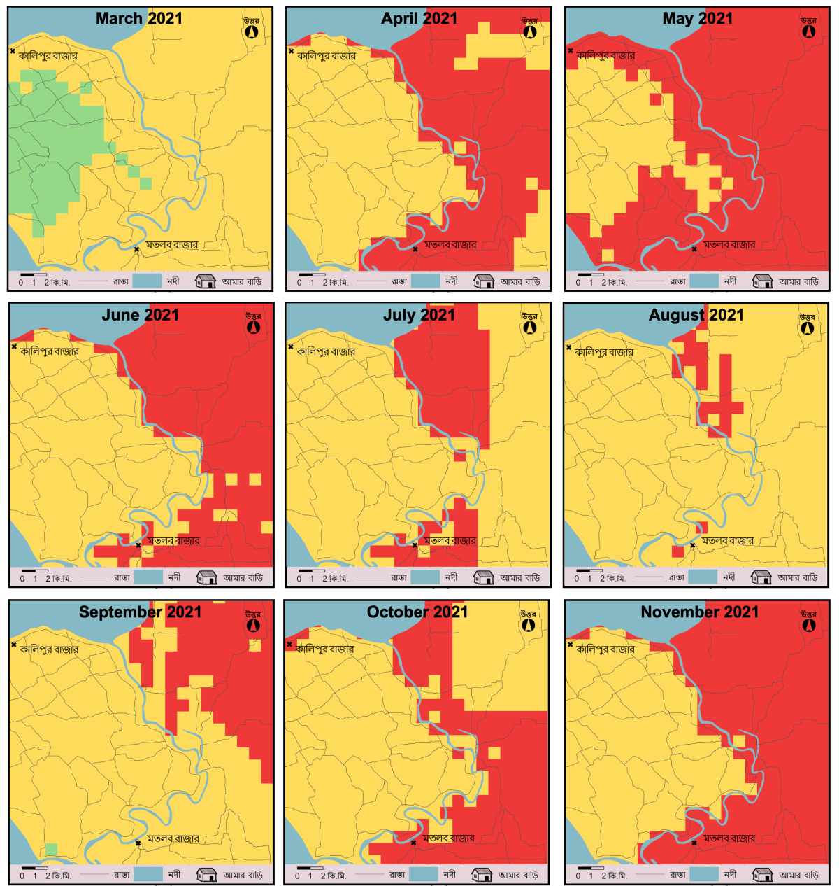
A team of researchers from Penn State, Moravian University, Virginia Tech, and the University of Rhode Island, in collaboration with field researchers from icddr,b (the International Centre for Diarrhoeal Disease Research, Bangladesh), set out to investigate the feasibility of developing an early warning system for cholera risk in Bangladesh. Using remote sensing data such as rainfall observations, anomalies, and forecasts, temperature, and elevation, along with data on population density and past cholera incidence, the team developed a model to predict monthly cholera risk at a one km2 resolution. We calibrated the model to Matlab, a rural sub-district of Bangladesh approximately 50 km southeast of the capital city of Dhaka. For 2021, the year of the study, the risk predictions mirrored the dual-peaked seasonality of cholera in the Matlab area—with spikes in the pre-monsoon (April-June) and post-monsoon (October-December) seasons.
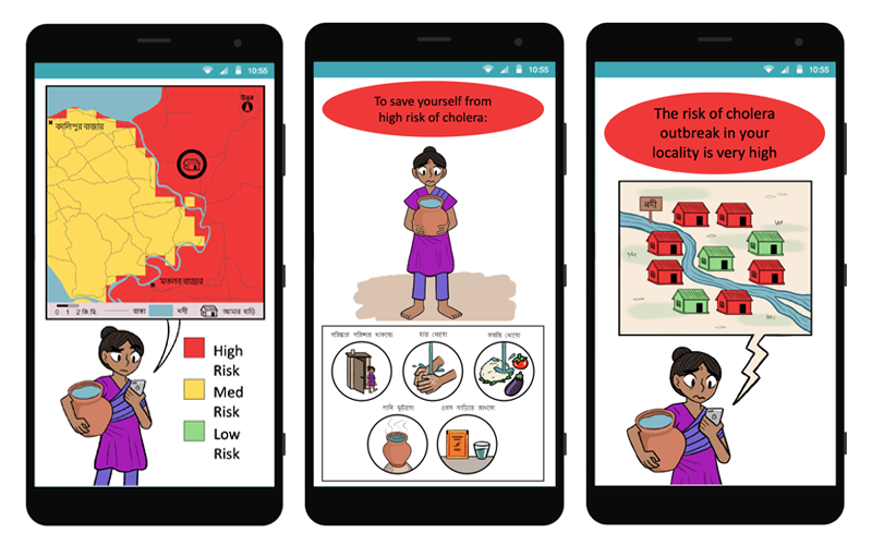
To communicate the modeled cholera risk predictions to households in Matlab, we developed a smartphone application called CholeraMap. CholeraMap is an Android phone application that allows users to view the modeled risk predictions—discretized into low, medium, and high-risk categories—for both their community and their home location. In addition to the risk levels, the app provides users with information to interpret the low, medium, or high-risk category into which their household’s location falls as well as public health information about reducing cholera transmission.
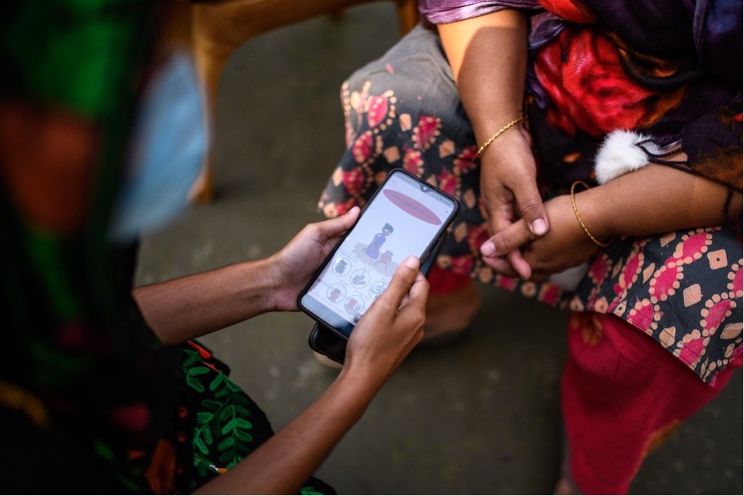
We installed CholeraMap on the smartphones of approximately 750 households across Matlab. In addition, our sample included another 750 households that received a companion app—CholeraApp—which provided only publicly available information about averting cholera as well as 500 households that did not receive access to either app. Including these households in our sample allowed us to assess the value of providing geographically specific, dynamic risk predictions to end-user households via CholeraMap.
Using a smartphone application to disseminate cholera risk predictions and information in rural Bangladesh was not without challenge. First, while mobile phone technology has expanded substantially across low-income countries, smartphones are less ubiquitous. Only about 60 percent of households in Matlab owned smartphones at the time of the study. This means our sample of smartphone-owning households may differ from the profile of the average household in Matlab. Nevertheless, mobile phones and smartphone applications provide a low-cost and scalable platform for information dissemination, with important implications for policy design. Second, data access, phone storage, and connectivity challenges posed a threat to sample recruitment. To circumvent these challenges, the app was designed to use as little data and storage space as possible. Despite these implementation challenges, our installations of CholeraMap demonstrate that mobile and smartphones can be a valuable intervention platform and our analysis of app use suggests that users found the dynamic nature of the information provided by CholeraMap to be of value.
To assess the impacts of CholeraMap on household behavior and health, we conducted a household survey among study households prior to the app installations (March 2021) as well as following the study intervention period (October 2021). In these surveys, we asked respondents about their households’ water use, sanitation, and hygiene practices, recent health experiences, water security, and, at endline, experiences using CholeraMap. We also followed up with households every month during the intervention period with short phone interviews to assess app use, identify any technical issues with CholeraMap, and gauge changes in water, sanitation, and hygiene practices. We used these survey data to assess whether households used the information in CholeraMap to update their behavior as it related to reducing the risk of cholera transmission.
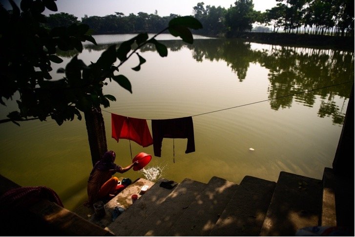
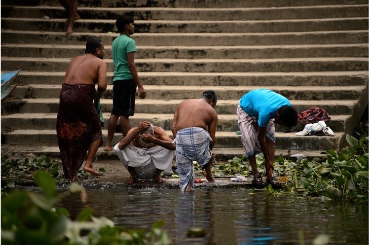
Compared to households without CholeraMap, households using CholeraMap reduced their reliance on surface water during the intervention period. Surface water is an important water source in Matlab, particularly for washing clothes and cooking utensils, as well as bathing. Yet, contaminated surface water is a key transmission pathway for cholera. Accordingly, by limiting surface water use, CholeraMap households were reducing their private disease risk through their preventative behavior. We find that this behavioral change was driven by households living in parts of Matlab that received high cholera risk warnings during the intervention period, suggesting that this dynamic information was critical in shaping household behavioral response.
Responding to long-standing pandemics and decreasing the morbidity and mortality burdens of cholera in areas—such as Bangladesh—where the disease remains endemic are key public health priorities. Interdisciplinary research that focuses on using available data, such as earth observations, to develop user-friendly early warning systems for disease offers a way to better understand the environmental and behavioral dimensions of disease risk reduction. Further, communication via phone platforms offers a practical option for policymakers and public health practitioners interested in reaching at-risk populations. In the case of cholera in Bangladesh, we find that access to dynamic risk information can help households make safer water choices. Tailoring such information to those at the highest risk could help to reduce cholera transmission in endemic areas.
Emily Pakhtigian is a cofunded faculty member of the Institutes of Energy and the Environment. She is also an assistant professor in Penn State's School of Public Policy. Her research examines the causes and consequences of human interactions with the natural environment, with a particular focus on low- and middle-income country contexts.
Pakhtigian, E. L., Aziz, S., Boyle, K., Akanda, A. S., & Hanifi, M. A. (2022). Early Warning Systems, Mobile Technology, and Cholera Aversion: Evidence from Rural Bangladesh. https://www.rff.org/publications/working-papers/early-warning-systems-mobile-technology-and-cholera-aversion-evidence-from-rural-bangladesh/
This research was supported in part through the National Aeronautics and Space Administration cooperative agreement number NNX17AD26A with Resources for the Future to estimate the VOI obtained from satellite-based remote sensing and through the Population Research Institute (PRI) at Pennsylvania State University.